POLARIS
Overview
Polaris is a data analytics solution which optimizes fishing and navigation operations, tailored to fishing in Polar regions, aiming to increase the economic and environmental sustainability of fishing. Polar fisheries are particularly interesting due to challenges of sustainability in rapidly evolving and sensitive aquatic ecosystems; however, unlike many fisheries the market potential and opportunity is expanding, yet hazards and expensive operations currently limit this expansion. Polaris enables data driven precision fishing, to unlock the bounty of these inhospitable seas while ensuring the ecological sustainability of these fisheries for future generations.
Problem
Fishing is inherently uncertain and complex, and it is even more so in polar regions: conditions are harsh and dangerous; navigation and fish distribution are affected by a multitude of oceanographic, weather, biological, ecosystem factors. Our changing climate creates new opportunities, yet renders the prior experience of captains increasingly less reliable or relevant. Aquatic ecosystems are often threatened by fisheries and there are ever increasing pressures on the seafood industry for sustainability, and increasingly complex regulations. These intertwined and evolving factors lead to high operational costs and an uncertain business landscape in polar fisheries. A new paradigm is needed to enable fisheries to adapt with agility to the shifting baselines and evolving seascape.
Fisheries face therefore several problems:
- Fisheries are not using optimization for route planning.
- Fisheries operate quite often in severe weather conditions.
- Fisheries face high competition and need to reduce operational costs.
- Available solutions to identify fishing grounds are not dynamic charts and not in real time.
- Fisheries lose money having by-catch.
- Climate change is moving the fish stocks.
Solution
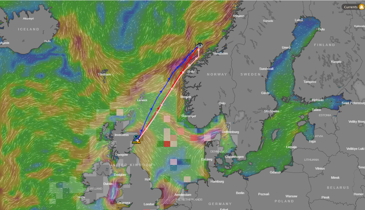
Polaris is an end-to-end decision support tool for polar precision fisheries solving the above-mentioned problems through optimizing navigation routes and identifying sustainable fishing grounds, dynamically updated to meet user needs in near-real-time. Polaris enables fishermen not only to dynamically locate optimal fishing grounds – both for target species and to avoid sensitive bycatch species, but also charting optimal routes between fishing grounds and/or ports.
Product
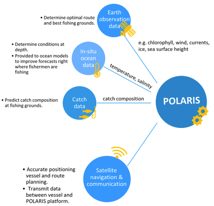
Polaris is built from several satellite services: Earth Observation data, essential to determine the optimal route and best fishing grounds, Satellite Navigation, for accurate positioning of the vessel and route planning, and Satellite Communications to transmit data between the vessel and Polaris service platform. Additionally, the system includes in-situ data from temperature and salinity sensors attached to fishing gears to measure ocean conditions at depth. These in-situ data work in synergy with EO data to identify fishing locations but are also sent back to the infrastructures that provide ocean forecasts in those regions. Therefore, Polaris directly improves forecasts exactly where the fishermen are fishing.
Competitors
Data-driven models and forecasts can be used to predict outcomes of a rapidly changing ocean. Some fisheries currently use specific software packages developed to provide key information to the fishermen to decide which fishing grounds may be more interesting. One of the most used solution used by fisheries operating in the Atlantic Ocean is Catsat, which provides qualitative information to the fishermen to make decisions. Unfortunately Catsat does not provide this information on a near-real-time basis but only through static maps.
Business model
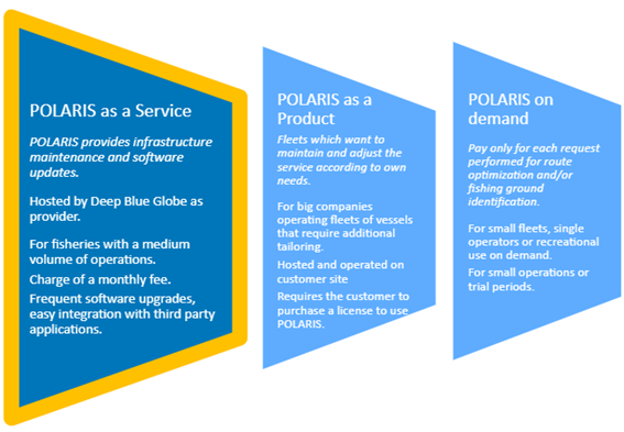
After an initial installation fee, Polaris provides the software, infrastructure maintenance and regular software updates according to a monthly subscription. Upon customer request, Polaris can also be provided as a product or a system.
Impacts
Polaris saves operational costs for the fisheries and vessel operators, but it also reduces some key environmental impacts related to fishing. The reduction of greenhouse gas emissions induced by the fuel cost reduction follows the IMO challenges and acts positive on the environment. Additionally, the by-catch and therefore the pressure on fish stocks will be reduced.